Marine Habitats
Suffolk’s marine habitats extend from the intertidal mudflats and saltmarshes of its estuaries to the offshore subtidal sands, gravels and deeper water muds of the southern North Sea. The seabed off the Suffolk coast provides nursery and spawning grounds for commercially important fish species, foraging habitat for marine mammals and seabirds, and supports communities of invertebrates and marine plants of national and European conservation importance. Several of these habitats are protected through a network of designated sites – Marine Conservation Zones, Special Areas of Conservation and Special Protection Areas – that together cover much of Suffolk’s coastal and offshore marine environment.
Suffolk’s marine habitat types
The principal marine habitat types occurring in Suffolk’s territorial and nearshore offshore waters include:
- Seagrass beds: shallow subtidal and intertidal meadows of Zostera spp., providing nursery habitat for fish and invertebrates and supporting overwintering wildfowl including Dark-bellied Brent Goose.
- Subtidal sands and gravels: extensive mobile and stable seabed habitats supporting diverse communities of invertebrates, fish and foraging seabirds.
- Sheltered muddy gravels: mixed sediment habitats in more sheltered inshore areas, supporting a distinct invertebrate assemblage.
- Mud habitats in deep water: fine-sediment communities in deeper offshore areas, often of considerable ecological complexity.
- Intertidal mudflats and sandflats: the primary feeding habitat for waders and wildfowl in Suffolk’s estuaries, supporting large biomasses of invertebrates including Macoma balthica and Manayunkia aestuarina.
- Coastal lagoons: enclosed or semi-enclosed saline water bodies; the finest examples in Suffolk are found within the Orfordness – Shingle Street SAC and support the Starlet Sea-anemone and specialist lagoonal invertebrate communities.
Marine Conservation Zones
Marine Conservation Zones (MCZs) are marine protected areas in UK territorial and offshore waters, designated to protect nationally important marine habitats and species.
Orford Inshore MCZ
Located approximately 14km offshore, the Orford Inshore MCZ is an important nursery and spawning ground for a range of fish species, including Dover Sole, Lemon Sole, Sprat and Lesser Sandeel. The zone also supports Harbour Porpoise, skates, rays, Small-spotted Catshark and several crustacean species, as well as foraging seabirds.
- Fish associated with Suffolk’s marine zone
Allis Shad, Twaite Shad, European Eel, Raitt’s Sand Eel (Lesser Sandeel), Atlantic Herring, Common Skate, Atlantic Cod, Tope, Long-snouted Seahorse, Short-snouted Seahorse, Atlantic Halibut, River Lamprey, Monkfish, Whiting, European Hake, Ling, Smelt, Sea Lamprey, Plaice, Undulate Ray, White Skate, Atlantic Salmon, Brown or Sea Trout, Atlantic Mackerel, Dover Sole, Spiny Dogfish, Horse Mackerel
- Marine mammals associated with Suffolk’s marine zone
Minke Whale, Common Dolphin, White-beaked Dolphin, Common Seal, Harbour Porpoise, Striped Dolphin, Bottlenose Dolphin
Special Areas of Conservation with marine components
Special Areas of Conservation (SACs) with marine components protect Annex I habitats and Annex II species associated with the marine environment, from intertidal mudflats and coastal lagoons to subtidal and deeper-water habitats. Management measures may be required to maintain or restore the conservation status of protected features; the Marine Management Organisation is the lead authority for managing fishing activity within these sites.
Southern North Sea SAC: A key year-round habitat for Harbour Porpoise, designated for the importance of its offshore waters as a regular presence area for this species.
Alde, Ore and Butley Estuaries SAC: This SAC covers the three rivers of the Alde, Butley and Ore, together with Havergate Island, between Aldeburgh and Bawdsey. The River Alde runs south along the inner side of the Orfordness shingle spit, subsequently becoming the River Ore, with the Butley River joining shortly after Havergate Island. The estuary is bar-built – a partially drowned river valley with a sediment bar at the mouth – and is the only shingle-barred estuary in the UK. The shingle bar has historically migrated south-westwards steadily, moving the river mouth from its former position at Orford.
The overlapping Alde-Ore Estuary SPA holds nationally and internationally important populations of breeding and wintering birds, sustained by the quality of the estuary’s roosting habitats and invertebrate communities. The site contains 25 saltmarsh communities, including nationally important populations of the declining Small Cord-grass (Spartina maritima) and the scarce Long-bracted Sedge (Carex extensa).
Orfordness – Shingle Street SAC: This SAC extends along the coast between Aldeburgh and Bawdsey, designated for three qualifying features: coastal lagoons, stony banks above the high water mark and annual vegetation of drift lines. The 2013 tidal surge breached the site and significantly altered its physical character.
The most extensive feature is the stony banks of the shingle spit, particularly at the southern end, where shingle ridges support a varied community of specialist vegetation. Orford Ness holds one of the largest natural expanses of shingle vegetation affected by salt spray in the UK. The drift line vegetation – colonising the strandline on both the sheltered western side and the exposed eastern coast of the spit – is a rare fringing habitat of plant species tolerant to saltwater and periodic disturbance. The site’s coastal lagoons are among the finest examples in the UK: ranging from near-fresh to highly saline, they support specialist invertebrate communities and bird assemblages including Avocet, Spoonbill and the rare Starlet Sea-anemone.
Special Protection Areas with marine components
Special Protection Areas (SPAs) protect bird species listed under the Birds Directive that depend on the marine environment for all or part of their life cycle. The following SPAs along the Suffolk coast have marine components. Sixty bird species are currently protected in UK SPAs with marine components, and details of qualifying species and site boundaries are available on the JNCC MPA Mapper.
Outer Thames Estuary SPA: This SPA lies along the east coast of England in the southern North Sea, extending northward from the Thames Estuary to the sea area off Great Yarmouth. It crosses the 12 nautical mile boundary, and statutory advice is provided jointly between JNCC and Natural England.
Minsmere-Walberswick SPA: Located between Southwold and Sizewell, this SPA follows the boundaries of the Minsmere-Walberswick Heath and Marshes SSSI and includes both marine areas and terrestrial habitats beyond tidal influence. The site is an exceptional mosaic of freshwater and coastal grazing marsh, coastal reedbed, saltmarsh, lowland heathland, woodland and intertidal mud and mixed sediment. During severe winter weather it becomes even more important, as additional wildfowl and waders arrive from colder continental areas, attracted by the relatively mild coastal climate and abundant food resources.
Alde-Ore Estuary SPA: Located between Aldeburgh and Bawdsey, this SPA includes Havergate Island, Orford Ness and the estuaries of the rivers Alde, Butley and Ore. The site comprises Atlantic salt meadows, intertidal mudflats, shingle, coastal lagoons, and estuarine fish communities. Extensive intertidal mudflats in the Upper Alde Estuary and from Snape to North Weir Point provide key feeding habitat; as the tide advances, the saltmarsh becomes an important foraging area. The lagoons within the site provide additional feeding and nesting habitat.
Deben Estuary SPA: The Deben is a relatively sheltered, narrow estuary extending approximately 18km from near Woodbridge to the sea just north of Felixstowe, where shifting gravel and sandbanks shelter the mouth. Mudflats flank the length of the estuary, supporting diverse invertebrate communities and several patches of eel grass (Zostera spp.). Beyond the mudflats, saltmarsh includes the most diverse saltmarsh community in Suffolk, and the site supports important populations of overwintering waterbirds and waders.
Stour and Orwell Estuaries SPA: The Stour and Orwell Estuaries straddle the Suffolk-Essex border. Both are tidal, shallow and relatively sheltered, though the Orwell is narrower and more linear, while the Stour is wider, with extensive mudflats across five main bays. Invertebrate-rich intertidal mudflats flank both estuaries, with diverse saltmarsh communities at their edges. Several freshwater pools and grazing marshes fall within the SPA boundary, including Trimley and Shotley Marshes. The site supports an important number of overwintering waterbirds, using the mudflats for feeding and the saltmarsh and grazing marsh for roosting.
- Birds associated with Suffolk’s coastal and marine SPAs
Avocet, Bittern, Black-tailed Godwit, Common Tern, Cormorant, Curlew, Dark-bellied Brent Goose, Dunlin, Fulmar, Gadwall, Gannet, Great Crested Grebe, Greater White-fronted Goose, Goldeneye, Golden Plover, Grey Plover, Hen Harrier, Kittiwake, Knot, Lapwing, Lesser Black-backed Gull, Little Tern, Marsh Harrier, Nightjar, Oystercatcher, Pintail, Redshank, Red-throated Diver, Ringed Plover, Ruff, Sandwich Tern, Shelduck, Short-eared Owl, Shoveler, Spoonbill, Teal, Turnstone, Wigeon
Threats to marine habitats
- Insufficient coverage and connectivity of Marine Protected Areas, which need to function as an ecologically coherent network rather than a set of isolated reserves to support the recovery of mobile species and habitats.
- Overfishing and bycatch, including ongoing issues with discard practices, which affect both commercially targeted species and the seabirds and marine mammals that depend on fish as a food source.
- Poorly coordinated marine planning, resulting in cumulative impacts from fishing, offshore wind energy, aggregate extraction and oil and gas infrastructure that individually may be acceptable but together degrade the quality of marine habitat across large areas.
- Pollution, including sewage, agricultural chemicals and nutrient run-off from rivers, plastic debris, abandoned fishing gear and underwater noise from construction and shipping.
- Sea level rise and increased storm frequency, which alter sediment dynamics, accelerate coastal erosion and threaten the integrity of intertidal habitats, including mudflats, saltmarsh and coastal lagoons.
Further information
- Eastern Inshore Fisheries and Conservation Authority – Marine Protected Areas
- JNCC – Habitat descriptions: Mud habitats in deep water, Seagrass beds, Sheltered muddy gravels, Subtidal sands and gravels (all PDF)
- JNCC – MPA Mapper
- MAGIC – Interactive mapping including designations
- Marine Management Organisation – gov.uk
- Marine Management Organisation – East Inshore and East Offshore Marine Plans
- Suffolk Coasts and Heaths National Landscape – Estuaries and coast
- Suffolk Wildlife Trust – Habitats Explorer: Marine
- Wildlife Trusts – The Way Back to Living Seas (PDF)
- Making Space for Nature – Lawton Review, Defra, 2010 (PDF, historical reference)
- The Natural Choice: Securing the Value of Nature – Natural Environment White Paper, 2011 (PDF, historical reference)
Suffolk’s Coastal and Marine Habitats
Key
A conservation priority in Suffolk’s Historic Biodiversity Action Plan.
A key habitat for recovery under Suffolk’s Local Nature Recovery Strategy.


Marine habitats are primarily a part of the Coastal and Marine habitat group, but also feature in these habitat groups: Saltmarsh and Lagoon.
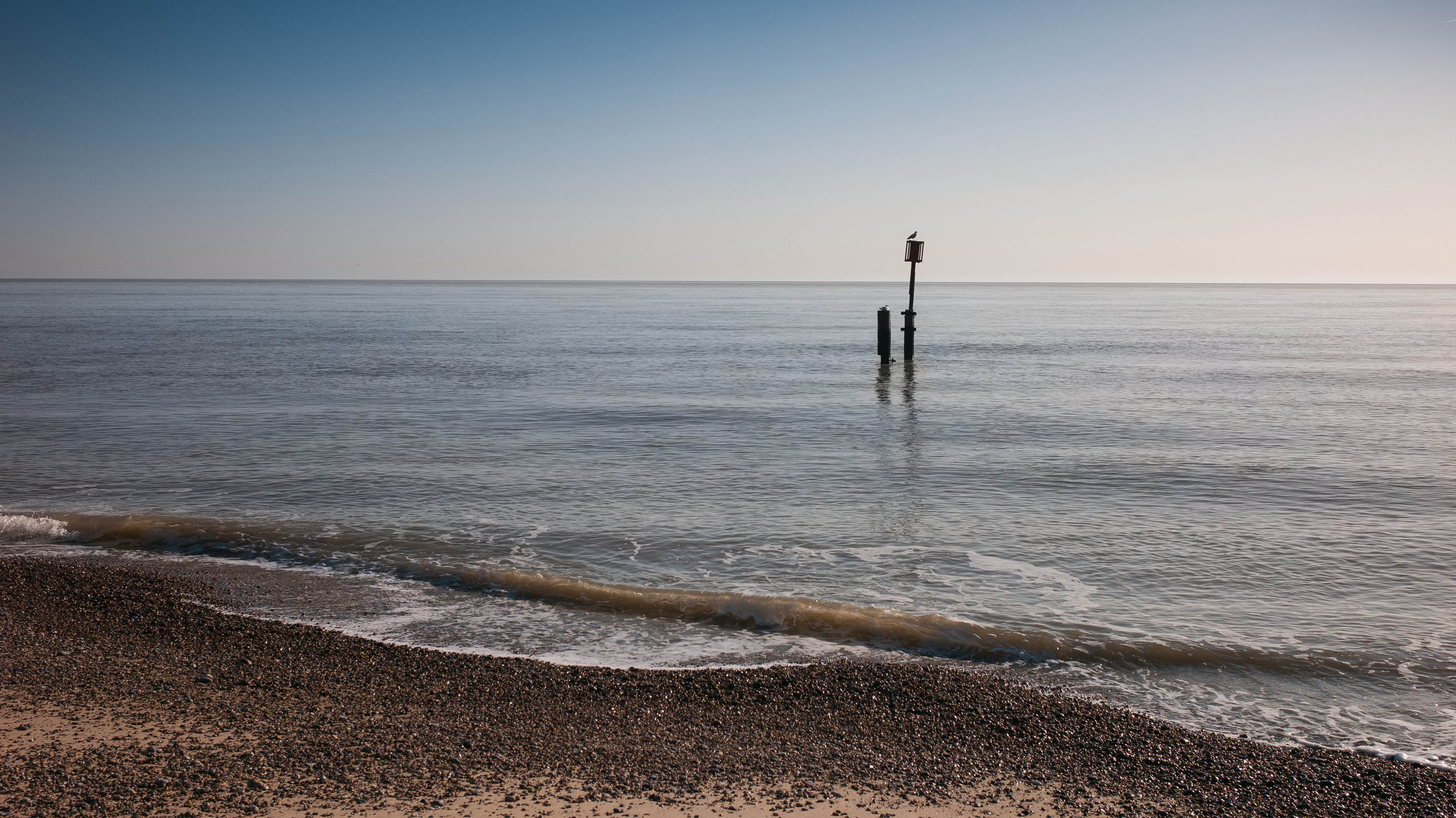
Image: Southwold © Alistair Hamilton
 Superseded – provided for reference only.") Archived Habitat Factsheet (PDF, 2020) Superseded – provided for reference only.
Archived Habitat Factsheet (PDF, 2020) Superseded – provided for reference only.
 Superseded – provided for reference only.") Archived Suffolk BAP action plan (PDF, 2003) Superseded – provided for reference only.
Archived Suffolk BAP action plan (PDF, 2003) Superseded – provided for reference only.